View in other NatureServe Network Field Guides
NatureServe
Montana
Utah
Wyoming
Idaho
Wisconsin
British Columbia
South Carolina
Yukon
California
New York
Streptanthella - Streptanthella longirostris
State Rank Reason (see State Rank above)
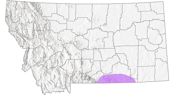
Uncommon in Montana and restricted in distribution to Carbon County. Population sizes are poorly documented and associated information on trends and threats are also lacking.
General Description
Glabrous, taprooted annual. Stems erect, branched, 15–40 cm. Leaves all cauline, sessile, narrowly oblanceolate, 3–5 cm long, entire to weakly dentate. Inflorescence an ebracteate raceme. Flowers white; petals 4–6 mm long. Fruits linear siliques, 3–6 cm long with a beak 4–6 mm long; style absent; seeds in 1 row per locule; pedicels reflexed, 1–3 mm long (
Lesica et al. 2012. Manual of Montana Vascular Plants. BRIT Press. Fort Worth, TX).
Species Range
Montana Range
Range Descriptions
 Native
Range Comments
Carbon County; WA, ID and MT south to CA, AZ, NM and Mexico (Lesica et al. 2012. Manual of Montana Vascular Plants. BRIT Press. Fort Worth, TX).
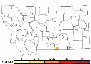
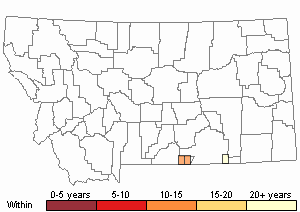
Observations in Montana Natural Heritage Program Database
Number of Observations: 42
(Click on the following maps and charts to see full sized version)
Map Help and Descriptions
Relative Density
Recency

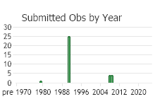
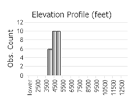 (Observations spanning multiple months or years are excluded from time charts)
Habitat
Open, often sandy soil in sagebrush grassland, desert shrubland, and juniper woodland in the valley and foothill zones.
Stewardship Responsibility
References
- Literature Cited AboveLegend:
 View Online Publication
- Lesica, P., M.T. Lavin, and P.F. Stickney. 2012. Manual of Montana Vascular Plants. Fort Worth, TX: BRIT Press. viii + 771 p.
- Additional ReferencesLegend: View Online Publication
Do you know of a citation we're missing? Al-Shehbaz, I. A. 1973. The biosystematics of the genus Thelypodium (Cruciferae). Contributions from the Gray Herbarium No. 204:3-148.
- Lesica, P. and P.L. Achuff. 1992. Distribution of vascular plant species of special concern and limited distribution in the Pryor Mountain desert, Carbon County, Montana. Unpublished report to the Bureau of Land Management. Montana Natural Heritage Program, Helena, MT. 105 pp.
- Lesica, P., M.T. Lavin, and P.F. Stickney. 2022. Manual of Montana Vascular Plants, Second Edition. Fort Worth, TX: BRIT Press. viii + 779 p.
- Rollins, R. C. 1993. The Cruciferae of Continental North America: systematics of the mustard family from the Arctic to Panama. Stanford University Press, Stanford, California. 976 pp.
- Web Search Engines for Articles on "Streptanthella"